Thursday, April 29, 2010

Alport Castles, Win Hill, Derwent Edge.

These are some of the pictures I took during my last walk. These deal with the route I took, mainly the forward view but there are a couple looking back. The green line indicates the line of the path I took.

Looking back down the path through the forest after leaving the car park.

Heading for Alport Castles.

The route down the valley to the Snake Pass road (A57).


Looking back to where we just came from.
Win Hill is what we're aiming for next that they is where the red dot is.
The some of the route forward from Win Hill.
Looking back over the Ladybower Reservoir.
Looking across the valley to Win Hill.
The route to Back Tor.
The Route to Lost Lad.
Across the moor to the Derwent Valley.
Down there at the end of that water is the end of the walk but you know Bob won't let you get away with it that easy. Instead we have to turn and head off in the other direction for another mile as there is something I want to show you although knowing you lot all this extra two miles won't even raise a comment but thats the way I am, I just think about you all the time and will go out of my way just to try and make you all happy...
So here is what I wanted you to see, its turned a bit dull and misty but hopefully you can see why I bought you all this way round.

Wednesday, April 07, 2010

Moscar - Rowsley (The Last Part)

As promised here are the rest of the pictures of my last walk through Chatsworth Estate to my destination at Rowsley. First of all thought here is a link to Chatsworth so you can get more info on the place if you wish.

http://www.peakdistrictonline.co.uk/content.php?categoryId=1074

The first picture shows the cricket field and pavilion in Chatsworth Park, when I was a garden boy and learning my trade one of my jobs after I'd been there a few years was to be sent down here once a week through the summer to mow the grass. You can't tell from the picture but the pavilion has a thatched roof.

In this next picture you will see Queen Mary's Bower, for more about this go to the link above as really I'm no history teacher so you're best to learn about it from someone who knows what they're talking about.

I include this next picture simply because in the far distance you can just make out the Village of Beeley which is where my dad's side of the family come from. I never actually lived there myself, when I was born we lived up on the hill you can see behind the village. I did go to Beeley school though so from age of five I used to walk from home down through the woods and fields you can see on the hillside behind the village every morning and then back again in the evening.

After a year at Beeley school part of our house blew down one night in a storm and we had to move out to a place in the Village of Rowsley which is only a mile from Beeley. So really Rowsley is my home and my parents still live in the house I grew up in and that is where I was headed this day. Here you see the route by the River Derwent just a short distance before it enters the village.

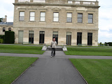
This is my parents house and where I lived from the age of seven, this picture was not taken on the day though and is one from a while ago.

Tuesday, April 06, 2010

Longshaw To Baslow.

In this post I will show you some of the things I saw between Longshaw Lodge and Baslow.
Longshaw Lodge is now owned by the National Trust but was originally built by The Duke of Rutland as a shooting retreat. The lodge was built near to a toll road but the Duke liking his privacy got the road diverted. This shows the power these people had in Victorian times.

The walk through the Longshaw country park is level and on a good track at the end of which is the pub. I didn't get a picture of the beer Sara because I didn't stop - I know, how boring am I?!! Anyway all along the path there are good views to be had over the Derwent Valley, there are even better to be seen after the pub though.

On the hill just before desending in to Baslow is Wellington's Monument ....and close by was this character with a few of his mates.

In the next post we will be taken in Chatsworth Park.

Sunday, April 04, 2010

Stanage Edge (Part Three).

Hello everyone,

Here are some more pictures taken on my last walk, they are some of the interesting things I saw along the way.


I've been given several explanations as to what purpose the item in the first picture serves but I can't make my mind up which one to believe so I won't risk telling you something that isn't true. What is obvious is that they are intended to catch water presumable for something to drink. Not the two channels carved out in order to catch and then divert the water that runs down the rock and guide it in to the small bowl. There are many of these along Stanage Edge all of which are numbered this being number 4.

As you can see from the picture in the previous post Stanage Edge is a almost vertical cliff which is very popular with those that like to go rock climbing, it is easy to spend too much time there admiring their skills and what too me seems like bravery.

Many years back now these places had a much more productive roll to play in providing work for local people and different stone products for businesses such as mills and farms. Today the item below would look fine in many a garden and would cost a great deal to buy, here though it lies unfinished as an unofficial monument to the past. If you look inside you can still see the marks left by the person working on this project also I think the outside would have been finished to a much higher similar to the few inches at the top of the trough.


This next picture is something else that would have been made in such a place as Stanage Edge, its the old millstone outside the old flour mill in Chatsworth park.

I hope you find these things as interesting as I do, I will show you some more things from the walk when you've digested this lot. If you want to read more about Stanage Edge click on the title of this post.

Friday, April 02, 2010

Moscar - Rowsley (Part Two)

I have all the pictures ready now from last weekends walk, this is to be just the first post of several and mainly shows the route, I will present the side dishes in following posts as this is a very interesting walk. It totals eighteen miles in length but if you are capable of walking twelve to fifteen miles in the day you should manage this walk okay as it's easy walking mostly on the flat or down hill. There is a bit of a climb to start with but its very gentle. Also at the half way point there is a pub, the front door of which you pass unless you're tempted inside. It would also be a good place to break the walk up if you didn't fancy doing the whole thing in one go. So is Bob spoiling you or what? Not only does he find you a walk on a good path that's nearly all down hill, he provides a view at nearly ever single step and throws in some bonus points on interest and gives you a pub half way along the route, it doesn't get much better than this I tell you.
[As always click on the pictures you wish to enlarge]

This first picture is taken looking back to the A57 at Moscar which is where Vicki dropped me off. Thats the truth - she did drop me off and not kick me out and tell me to walk home. Shortly after starting this your route for the next four miles or so, all the time to your right there are staggering views to be had, in fact to the left also.

After the four mile walk along Stanage Edge we then follow the valley all the way down to the Longshaw Estate between Carl Wark and Burbage Edge.


Entering the Longshaw Estate.


The walk through the Longshaw Estate, the pub is not far away now.


Looking down the Derwent Valley, the walk ends somewhere in the far distance. From here we leave the high ground and walk by the river Derwent through the Chatsworth estate.

Looking back to Chatsworth House from the park. My route passing in front of the house.

Approacing the old mill that was closed in I think the sixties when I tree fell on it during a bad storm.

This next picture is the last for this post and shows the route between Calton Lees and Rowsley.

Whilst this is the last picture for this post its not the last of the walk. In the next post I will show you some of the interesting things I saw along the way so I hope you will join me another so I can share them with you.

Friday, March 26, 2010

Moscar - Rowsley

Tomorrow I'm off on another walk, as is the norm for this time of year the length of the walk has been extended over any previous ones under taken this year although the walk itself is easy and mostly on a good path and with lots of interesting things to see. This walk is not a round trip as vicki is dropping me off and picking me up later in the day. For those interested part of the route card and some details of the walk are printed below.

[Click to enlarge]

Saturday, March 20, 2010

Edale, Hollins Cross, Kinderscout.

Here are some of the pictures from last Saturdays walk. This walk was around twelve miles in length measured by my satnav, a wonderful thing not only for showing the way but also for gathering data about the walk. I can remember when I first started walking for pleasure distances had to be calculated using a piece of thread and then I got hi-tec and bought a little wheel thing that you pushed around the map trying to follow the route. I also had a thing that I clipped to my belt that was supposed to caculate the distance by how many steps you took but what that didn't take in to account that no step was ever the same length so that was never to be relied on. You're lucky now though because when I say I walked however many miles we can be pretty sure thats how far a did walk and not a rough guess. Another very useful addition to navigation is 'Mapyx Quo' GB mapping software, the application is free but you buy the maps that you need which I think are reasonably priced compared to the paper versions. By using this software you know before you start lots of data about the walk that you are to undertake like for instance last week the minimum altitude of the walk was 765 ft and the max was 1986.5 ft the average altitude being 1500 ft. Total ascent was 2377ft. I spent 5.97 miles climbing, 5.46 miles descending and 0.61 miles of level walking. When I've planned my route I can then download it to my Garmin satnav and also print off a route card to leave with someone in case something goes wrong and they have to send out a search party.
Anyway here are the pictures from the walk which was mostly around Edale taking in Mam Tor and part of Kinder Scout. If you're looking for a peaceful walk with few people I suggest you take a day trip by bus to London as you are sure to find more solitude there than you will on this walk. Even on a cold March day the place was full of people most of whom didn't even seem like they want to be there. For these reasons I rarely venture near Kinder Scout these days but as you can see from the above data its good for putting ascent and descent on your legs.
[Most pictures will enlarge when clicked on]
Edale Village

Crossing the valley


The ridge walk to Mam Tor


Rushup Edge

View from Rushup Edge
Looking towards Jacob's Ladder from Kinder Scout
As you can see from this picture one is never short of company
Looking down on Edale from the top of Grindsbrook, almost at the end of the walk.