Edale, Hollins Cross, Kinderscout.
Here are some of the pictures from last Saturdays walk. This walk was around twelve miles in length measured by my satnav, a wonderful thing not only for showing the way but also for gathering data about the walk. I can remember when I first started walking for pleasure distances had to be calculated using a piece of thread and then I got hi-tec and bought a little wheel thing that you pushed around the map trying to follow the route. I also had a thing that I clipped to my belt that was supposed to caculate the distance by how many steps you took but what that didn't take in to account that no step was ever the same length so that was never to be relied on. You're lucky now though because when I say I walked however many miles we can be pretty sure thats how far a did walk and not a rough guess. Another very useful addition to navigation is 'Mapyx Quo' GB mapping software, the application is free but you buy the maps that you need which I think are reasonably priced compared to the paper versions. By using this software you know before you start lots of data about the walk that you are to undertake like for instance last week the minimum altitude of the walk was 765 ft and the max was 1986.5 ft the average altitude being 1500 ft. Total ascent was 2377ft. I spent 5.97 miles climbing, 5.46 miles descending and 0.61 miles of level walking. When I've planned my route I can then download it to my Garmin satnav and also print off a route card to leave with someone in case something goes wrong and they have to send out a search party.
Anyway here are the pictures from the walk which was mostly around Edale taking in Mam Tor and part of Kinder Scout. If you're looking for a peaceful walk with few people I suggest you take a day trip by bus to London as you are sure to find more solitude there than you will on this walk. Even on a cold March day the place was full of people most of whom didn't even seem like they want to be there. For these reasons I rarely venture near Kinder Scout these days but as you can see from the above data its good for putting ascent and descent on your legs.
[Most pictures will enlarge when clicked on]
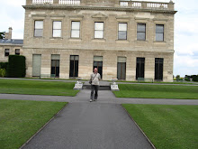
Edale Village
 Crossing the valley


 The ridge walk to Mam Tor
Rushup Edge
View from Rushup Edge Looking towards Jacob's Ladder from Kinder Scout
 As you can see from this picture one is never short of company
 Looking down on Edale from the top of Grindsbrook, almost at the end of the walk.
posted by Bob at
1:29 PM
![]()
![]()


5 Comments:
It's ironic that such an empty place, should be famous for its emptiness and have people there! I love the picture of the gap in the middle with the bridge over. The others are good too but that's my favourite.
Always delightful joining you on your rambles. Stunning photos as is your custom!
Approvingly your article helped me very much in my college assignment. Hats off to you dispatch, will look ahead for the duration of more interrelated articles without delay as its anecdote of my pick question to read.
I've recently bought a basic GPS locator and find it very useful...it doesn't have all the features of your satnav device though.
Amazing pics :) :) Was going through my blog when I came across a comment that you had made long back on on eof my posts...Thot I'd chk ur blog..N I'm glad I did so..Amazing clicks!!!
Post a Comment
Subscribe to Post Comments [Atom]
<< Home