Margery Hill Walk.
This is a pretty easy route to follow having Abbey Brook and then the edge along Margery Hill on your left for most of the way and then the Howden and Derwent reservoirs to your right on the return journey.
There are no really hard climbs, I think the most physical part being between the junction with the Smallfield Path and the Margery Hill Edge where it can be boggy, it could also be easy to stray of the way in bad visibility but with the waypoints provided at the end of this post you should have no trouble following the route, especially with a GPS. All grid references were taken during the walk and not from a map so should be spot on accurate. I’ve used the 10 numbers given to me by my GPS but if you prefer to use the usual 6 numbers just omit numbers 4,5,9 and 10 and you will be left with the usual 6 number grid reference.
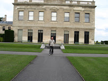
If anyone does use this post to walk the route I would love to hear how it goes for you. The pictures included are to highlight parts of the route rather than the best views along the way so don’t go thinking I showed you everything there is to see.
Date
26th July 2008
Distance
12.5 miles
Time Taken
7 hrs 8 mins
Moving Time
3 hrs 36 mins

 Approaching Abbey Brook Path - SK 17353 90905
 Path splits through the gate, (keep left) - SK 17251 91967
 1st stream crossing - SK 17762 92020
 Approaching 2nd stream crossing - SK 18497 92233
 Nearing Junction with Lost Lad Path - SK 19698 92370
 Junction with Smallfield path - SK 20762 93420
 Margery Hill Edge 1 - SK 18941 94736

Way Point 4 - SK 17683 95453
 Approaching Slippery Stones - SK 16957 95243
 Approaching the 1st Coldside Gate - SK 17230 94355
 Fairholmes - SK 17255 89287
Derwent Dam - SK 17428 89881
Bradfield Path - SK 17353 90905
Abbey Brook Path - SK 17353 90905
Path splits (keep left) - SK 17251 91967
There are no really hard climbs, I think the most physical part being between the junction with the Smallfield Path and the Margery Hill Edge where it can be boggy, it could also be easy to stray of the way in bad visibility but with the waypoints provided at the end of this post you should have no trouble following the route, especially with a GPS. All grid references were taken during the walk and not from a map so should be spot on accurate. I’ve used the 10 numbers given to me by my GPS but if you prefer to use the usual 6 numbers just omit numbers 4,5,9 and 10 and you will be left with the usual 6 number grid reference.
If anyone does use this post to walk the route I would love to hear how it goes for you. The pictures included are to highlight parts of the route rather than the best views along the way so don’t go thinking I showed you everything there is to see.
Date
26th July 2008
Distance
12.5 miles
Time Taken
7 hrs 8 mins
Moving Time
3 hrs 36 mins
Derwent Dam - SK 17428 89881
Approaching Bradfield Path - SK 17353 90905
 Approaching Abbey Brook Path - SK 17353 90905
 Path splits through the gate, (keep left) - SK 17251 91967
 1st stream crossing - SK 17762 92020
 Approaching 2nd stream crossing - SK 18497 92233
 Nearing Junction with Lost Lad Path - SK 19698 92370
 Junction with Smallfield path - SK 20762 93420
 Margery Hill Edge 1 - SK 18941 94736
Way Point 4 - SK 17683 95453
 Approaching Slippery Stones - SK 16957 95243
 Approaching the 1st Coldside Gate - SK 17230 94355
 Fairholmes - SK 17255 89287
Derwent Dam - SK 17428 89881
Bradfield Path - SK 17353 90905
Abbey Brook Path - SK 17353 90905
Path splits (keep left) - SK 17251 91967
1st stream crossing - SK 17762 92020
2nd stream crossing - SK 18497 92233
Junction with Lost Lad Path - SK 19698 92370
4th stream crossing - SK 20111 92323
Junction with Back Tor path - SK 20760 93197
Junction with Smallfield path - SK 20762 93420
Way Point 1 - SK 19828 94120
Way Point 2 - SK 19457 94450
Way Point 3 - SK 19119 94590
Margery Hill Edge 1 - SK 18941 94736
Margery Hill Edge 2 - SK 18715 95722
Junction with Slippery Stones path - SK 18567 96058
Path To Slippery Stones - SK 18306 95880
Way Point 4 - SK 17683 95453
Way Point 5 - SK 17338 95326
Slippery Stones - SK 16957 95243
1st Coldside Gate - SK 17230 94355
Howden Clough Path - SK 17410 93188
Howden Dam - SK 17134 92398
Abbey Brook Path - SK 17065 91933
Bradfield Path - SK 17353 90905
Derwent Dam - SK 17428 89881
Fairholmes - SK 17255 89287
posted by Bob at
6:52 PM
7 Comments
![]()
![]()